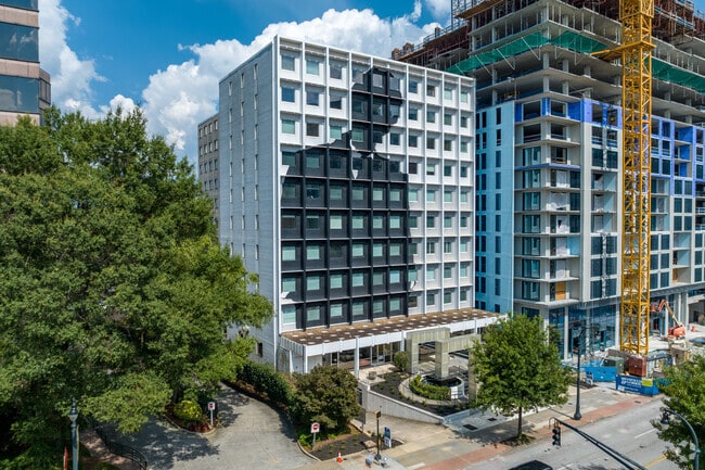
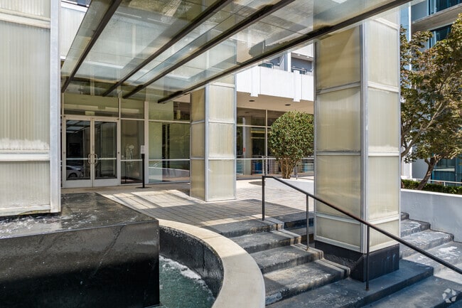
Property Record
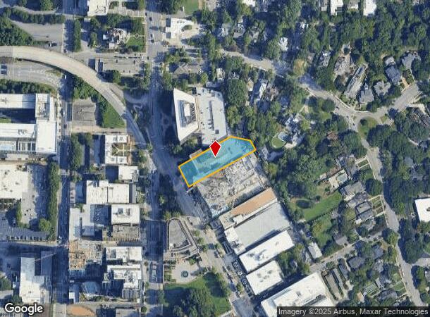
1447 Peachtree St Ne, Atlanta, GA 30309

Current Lease Availabilities
NEARBY LISTINGS FOR SALE OR LEASE
Property Detail
1447 Peachtree St Ne
Atlanta-Sandy Springs-Roswell, GA
Peachtree
17-0105-0003-035-1
KA 1447 PEACHTREE CHECK SALE CHG LUC TO 3A4 FOR 2020 UPDATE MKT
Officebuilding
Fulton
X
Georgia
13121C0242F
2
2024
0.73 AC
2025
Midtown/Pershing Point
000400
Atlanta
193,250 SF
DEMOGRAPHICS near 1447 Peachtree St Ne
1 Mile
3 Mile
5 Mile
2024 Total Population
27,462
192,694
417,277
2029 Population
28,257
198,789
431,310
Pop Growth 2024-2029
+ 2.89%
+ 3.16%
+ 3.36%
Average Age
37
36
37
2024 Total Households
16,342
98,759
201,027
HH Growth 2024-2029
+ 2.92%
+ 3.49%
+ 3.63%
Median Household Inc
$105,186
$92,995
$89,751
Avg Household Size
1.60
1.70
1.90
2024 Avg HH Vehicles
1.00
1.00
1.00
Median Home Value
$492,474
$578,531
$532,820
Median Year Built
2001
1996
1993
Nearby Places
Map Layers
Map Styles
 Street
 Aerial
- Restaurants
- Banks
- Shops
- Fitness
- Groceries
PUBLIC TRANSPORTATION
COMMUTER RAIL
DRIVE
WALK
Distance
2 min
12 min
0.6 mi
AIRPORT
Hartsfield - Jackson Atlanta International
DRIVE
WALK
Distance
Hartsfield - Jackson Atlanta International
21 min
12.9 mi
Nearby Properties
Address
Land Use
TOTAL SIZE
Lot Size
Zoning
Address
Land Use
TOTAL SIZE
Lot Size
Zoning
19.94 AC
SPI1
Address
Land Use
TOTAL SIZE
Lot Size
Zoning
1,585,451 SF
1.97 AC
SPI2
Address
Land Use
TOTAL SIZE
Lot Size
Zoning
2,283,599 SF
12.93 AC
I1
Address
Land Use
TOTAL SIZE
Lot Size
Zoning
9.80 AC
C5
Address
Land Use
TOTAL SIZE
Lot Size
Zoning
179.40 AC
R4
Address
Land Use
TOTAL SIZE
Lot Size
Zoning
3.16 AC
SPI1
Address
Land Use
TOTAL SIZE
Lot Size
Zoning
9 AC
C5
Address
Land Use
TOTAL SIZE
Lot Size
Zoning
10.27 AC
C5
Address
Land Use
TOTAL SIZE
Lot Size
Zoning
1,039,831 SF
0.31 AC
C4
Address
Land Use
TOTAL SIZE
Lot Size
Zoning
1,227,912 SF
2.15 AC
SPI4
Address
Land Use
TOTAL SIZE
Lot Size
Zoning
1,736,017 SF
3.63 AC
SPI2
Address
Land Use
TOTAL SIZE
Lot Size
Zoning
2,044,200 SF
9.16 AC
C3
Address
Land Use
TOTAL SIZE
Lot Size
Zoning
1,300,309 SF
4.81 AC
SPI1
Address
Land Use
TOTAL SIZE
Lot Size
Zoning
1,434,872 SF
1.89 AC
SPI1
Address
Land Use
TOTAL SIZE
Lot Size
Zoning
61.57 AC
C5
Address
Land Use
TOTAL SIZE
Lot Size
Zoning
1,116,157 SF
1.48 AC
SPI3
Address
Land Use
TOTAL SIZE
Lot Size
Zoning
1,467,469 SF
0.07 AC
C4
Address
Land Use
TOTAL SIZE
Lot Size
Zoning
903,671 SF
1 AC
C3
Address
Land Use
TOTAL SIZE
Lot Size
Zoning
10,954,869 SF
28.88 AC
C3
Address
Land Use
TOTAL SIZE
Lot Size
Zoning
1.55 AC
SPI1
Address
Land Use
TOTAL SIZE
Lot Size
Zoning
1,646,011 SF
3.74 AC
SPI4
Address
Land Use
TOTAL SIZE
Lot Size
Zoning
342,275 SF
0.70 AC
SPI3
Address
Land Use
TOTAL SIZE
Lot Size
Zoning
903,732 SF
0.34 AC
SPI1
Address
Land Use
TOTAL SIZE
Lot Size
Zoning
467,847 SF
1.62 AC
I2
Address
Land Use
TOTAL SIZE
Lot Size
Zoning
1,314,183 SF
2.61 AC
SPI1
Address
Land Use
TOTAL SIZE
Lot Size
Zoning
2,577,342 SF
2.04 AC
SPI1
Address
Land Use
TOTAL SIZE
Lot Size
Zoning
1,356,182 SF
2.52 AC
SPI4
Address
Land Use
TOTAL SIZE
Lot Size
Zoning
1,121,700 SF
2.21 AC
I2
Address
Land Use
TOTAL SIZE
Lot Size
Zoning
13,340,229 SF
3.68 AC
SPI1
Address
Land Use
TOTAL SIZE
Lot Size
Zoning
415,551 SF
1.13 AC
C4
The World's #1 Commercial Real Estate Marketplace
Connect with us
© 2025 CoStar Group
The information above has been obtained from sources believed reliable. While we do not doubt its accuracy we have not verified it and make no guarantee, warranty or representation about it. It is your responsibility to independently confirm its accuracy and completeness. Any projections, opinions, assumptions, or estimates used are for example only and do not represent the current or future performance of the property. The value of this transaction to you depends on tax and other factors which should be evaluated by your tax, financial, and legal advisors. You and your advisors should conduct a careful, independent investigation of the property to determine to your satisfaction the suitability of the property for your needs.